Developing Burn Plans For Individual Burns
Table of Contents
A complete burn plan is the first step toward executing a successful burn. Refer to Appendix 9D for a sample prescribed burn management plan, which includes the following details.
Location
Identify the areas within a burn site that will benefit most from prescribed fire. A complete burn of an area is not always desired. Leaving some areas unburned allows many insects, birds and small mammals to find refuge from the fire. A mosaic of burned and unburned areas is ideal, as it allows wildlife populations to persist.
Weather Parameters
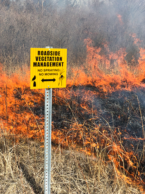
Weather is the most significant external factor influencing fire behavior, so it is crucial to determine the weather parameters within which each burn can be safely conducted. The following are reasonable guidelines for conducting most roadside burns.
- Temperature: 40–70°F
- Relative humidity: 30–70%
- Wind speed: 5–15 mph
- Wind direction: away from the road and areas with safety concerns
Information about the weather forecast leading up to the burn, as well as the weather data collected on-site, should be collected and recorded. See Appendix 9E for a sample of what this weather data collection effort looks like.
Equipment and Personnel Requirements
Identify one person as the burn boss and determine the number of people required to safely carry out the burn based on the size and complexity of the area in the prescription. Consider that additional support staff may be required in highly traveled areas to assist with traffic control and address questions from the public.
Prepare a site-specific list of ignition, firefighting, and safety equipment needed for the burn.
Potential Hazards
Potential hazards are anything that should not burn during the prescribed fire. This includes adjacent vegetation, utility poles and boxes, fences, signs, plastic culverts, and tile intakes. Identify these items in advance and mitigate the danger by reducing the fuel load around them and/or thoroughly watering the areas prior to ignition.
Firebreaks and Anchor Points
Firebreaks and anchor points are critical to starting and stopping a prescribed fire, and their respective locations should be identified in the burn plan. Roads, field drives, agricultural fields, mow lines, and wet lines may all be used as firebreaks.
The anchor point of a prescribed fire is the location where the fire is ignited. This is typically the most downwind position and must be completely secured by creating a barrier before continuing with the burn.
Special Concerns
Many other outside factors, such as traffic patterns near the burn site, visibility issues, residences, livestock operations, and power lines are areas of special concern that must be identified.
Also, be cautious about burning when there are culverts or drains under the road. Wind can carry embers through them and start a fire on the other side of the road.
Special concerns warrant additional mitigation procedures to ensure the safety of crew members and citizens and protect property. Conduct the burn when the wind direction will minimize the amount of smoke blowing into these areas of special concern.